Visual Arguments for citizen action
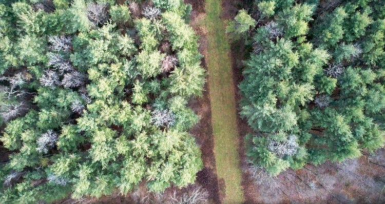
Across the Northeastern US, the health and wellbeing of local communities and fragile ecosystems are under significant threat due to an unprecedented rollout of Shale Gas infrastructure. This comes in the forms of fracked gas drilling pads (Hydraulic Fracturing), transecting pipelines and compressor stations. The rate at which this industrial complex is being developed across unsuspecting and utterly unprepared rural and natural environments is unprecedented. As late as 2005, this infrastructure did not exist in the Northeast Region. Only ten years later, hundreds of local communities and thousands of acres of heavily forested, often endangered ecosystems are being irreversibly damaged.
Accountability measures offered by the fossil fuel industry as well as state and federal interests are woefully inadequate. While this industrial onslaught is often marketed by the fossil fuel industry as a ‘net good’ for ‘energy independence’ across the region, in reality it has devastating consequences for local communities and natural environments that are caught completely off-guard with very few strategies and tools to advocate in defense of their health and wellbeing. In order to address this complex and fast-moving problem, faculty members Jess Irish and Stephen Metts have partnered with the non-profit Delaware Riverkeeper Network to create two distinct multimedia projects that offer different strategies for the same goal: visualizing pipeline impacts.
Jess Irish’s project “Community Action Against Pipeline Expansion” (CAAPE) is a mobile website that breaks down the impacts of gas pipelines into concrete, visual arguments. Irish identifies information overload / bureaucratese as a defining challenge for explicating the very real risks gas infrastructure poses to local townships. Most community meetings in these townships offer zero to little media / visual information when discussing possible impacts and actions. CAAPE is being developed as a structured website created almost entirely from infographics, sources originating in empirical and independent evidence. Ordered as layered themes, beginning with “big picture” issues on energy and scaling down to regional impacts and local projects, each layer will offer “visual arguments” that give citizens factually based information, linked reference documents, followed by timely actions an individual or community can take related to that topic.
One of the few current processes by which an individual or community group member may officially deliberate on a proposed project be it a pipeline or compressor station is within an ‘eComment’ placed in a Docket filing with the Federal Energy Regulatory Commission- FERC. At present, the process is so poorly designed most users give up, relying on non-profits such as Delaware Riverkeeper Network to assist in filing individual complaints. Documentation funding will allow for the creation of a step-by-step multimedia guide both on accessing the site, as well as offering effective, fact-based evidence to bolster individual participation in the FERC Process.
Stephen Metts received a TEDC grant in 2016 to create “Habitat Impact Mapper,” a mobile application that assists local (primarily rural) communities document local knowledge on a live map showing impacted areas for pipeline expansion. Community members will be enabled to literally map in situ local resources and knowledge that is either currently unmapped and thus technically indefensible; or slated to be irrevocably damaged or literally killed and destroyed due to their intersection with a proposed pipeline or compressor station right-of-way. This mapping resource uses cutting edge technology to offer authoritative and spatially accurate information, as well as allow multiple advocacy tools and outputs, beyond the strict confines of the eComment FERC process.
Access to this live map is restricted to volunteers working with Delaware Riverkeeper Network (DRN), a vibrant and effective non-profit that has been doing advocacy and environmental work for decades. Habitat Impact Mapper offers a highly interactive and accessible map populated not only with data disclosed by a proposed project, but augmented with local knowledge and in situ monitoring of natural resources. The result will provide community-sourced, accurately mapped factual impacts that can no longer be argued away by industrial and regulatory interests.


